The inscription might express the laws of the sanctuary, Warden said, perhaps outlining the ceremonies that took place there. Archaeologists have deciphered another word on the tablet, “Tina,” which refers to the head god of the Etruscan Pantheon (much like Zeus for the Greeks).
Science reporter Stephanie Pappas covered a new discovery from the SMU-sponsored dig at Poggio Colla, a key settlement in Italy for the ancient Etruscan civilization. Archaeologists previously found a 2500-year-old slab in the foundation of a monumental temple at the dig, and have determined now that sacred text on the stele, as it’s called, mentions the name “Uni,” an Etruscan fertility goddess.
Leading the project, which has been underway for more than two decades, is archaeologist Gregory Warden, professor emeritus at SMU. Warden is co-director and principal investigator of the Mugello Valley Archaeological Project, which made the discovery.
The Mugello Valley archaeologists are announcing discovery of the goddess Uni at an exhibit in Florence on Sept. 2, “Scrittura e culto a Poggio Colla, un santuario etrusco nel Mugello,” and in a forthcoming article in the scholarly journal Etruscan Studies.
By Stephanie Pappas
Live Science
An ancient tablet recently unearthed in Tuscany has revealed its first secret: the engraved name of a goddess linked to fertility.
The 500-pound (227 kilograms) stone slab, or stele, was unearthed earlier this year at Poggio Colla, a sixth century B.C. site built by the Etruscans. The stele bears a long inscription in a language that has not been used for 2,500 years, project archaeologist Gregory Warden, a professor emeritus at Southern Methodist University in Dallas, told Live Science in April.
Now, translation is underway and archaeologists have discovered that the tablet references the goddess Uni.
“We can at this point affirm that this discovery is one of the most important Etruscan discoveries of the last few decades,” Warden said in a statement. “It’s a discovery that will provide not only valuable information about the nature of sacred practices at Poggio Colla, but also fundamental data for understanding the concepts and rituals of the Etruscans, as well as their writing and perhaps their language.”
One of the longest Etruscan texts ever found, the inscription’s mention of Uni may indicate she was patroness of the Poggio Colla cult, with stone’s language spelling out ceremonial religious rituals
Archaeologists translating a very rare inscription on an ancient Etruscan temple stone have discovered the name Uni — an important female goddess.
The discovery indicates that Uni — a divinity of fertility and possibly a mother goddess at this particular place — may have been the titular deity worshipped at the sanctuary of Poggio Colla, a key settlement in Italy for the ancient Etruscan civilization.
The mention is part of a sacred text that is possibly the longest such Etruscan inscription ever discovered on stone, said archaeologist Gregory Warden, professor emeritus at Southern Methodist University, Dallas, main sponsor of the archaeological dig.
Scientists on the research discovered the ancient stone slab embedded as part of a temple wall at Poggio Colla, a dig where many other Etruscan objects have been found, including a ceramic fragment with the earliest birth scene in European art. That object reinforces the interpretation of a fertility cult at Poggio Colla, Warden said.
Now Etruscan language experts are studying the 500-pound slab — called a stele (STEE-lee) — to translate the text. It’s very rare to identify the god or goddess worshipped at an Etruscan sanctuary.
“The location of its discovery — a place where prestigious offerings were made — and the possible presence in the inscription of the name of Uni, as well as the care of the drafting of the text, which brings to mind the work of a stone carver who faithfully followed a model transmitted by a careful and educated scribe, suggest that the document had a dedicatory character,” said Adriano Maggiani, formerly Professor at the University of Venice and one of the scholars working to decipher the inscription.
“It is also possible that it expresses the laws of the sanctuary — a series of prescriptions related to ceremonies that would have taken place there, perhaps in connection with an altar or some other sacred space,” said Warden, co-director and principal investigator of the Mugello Valley Archaeological Project that made the discovery.
Warden said it will be easier to speak with more certainty once the archaeologists are able to completely reconstruct the text, which consists of as many as 120 characters or more. While archaeologists understand how Etruscan grammar works, and know some of its words and alphabet, they expect to discover new words never seen before, particularly since this discovery veers from others in that it’s not a funerary text.
The Mugello Valley archaeologists had planned to announce discovery of the goddess Uni at an exhibit in Florence on Aug. 27, “Scrittura e culto a Poggio Colla, un santuario etrusco nel Mugello,” and in a forthcoming article in the scholarly journal Etruscan Studies. The exhibit opening has been delayed to Sept. 2 due to the recent devastating earthquake in areas of Italy unrelated to the Poggio Colla research.
Text may specify the religious ritual for temple ceremonies dedicated to the goddess
It’s possible the text contains the dedication of the sanctuary, or some part of it, such as the temple proper, so the expectation is that it will reveal the early beliefs of a lost culture fundamental to western traditions.
The sandstone slab, which dates to the 6th century BCE and is nearly four feet tall by more than two feet wide, was discovered in the final stages of two decades of digging at Mugello Valley, which is northeast of Florence in north central Italy.
Etruscans once ruled Rome, influencing that civilization in everything from religion and government to art and architecture. A highly cultured people, Etruscans were also very religious and their belief system permeated all aspects of their culture and life.
Inscription may reveal data to understand concepts and rituals, writing and language
Permanent Etruscan inscriptions are rare, as Etruscans typically used linen cloth books or wax tablets. The texts that have been preserved are quite short and are from graves, thus funerary in nature.
“We can at this point affirm that this discovery is one of the most important Etruscan discoveries of the last few decades,” Warden said. “It’s a discovery that will provide not only valuable information about the nature of sacred practices at Poggio Colla, but also fundamental data for understanding the concepts and rituals of the Etruscans, as well as their writing and perhaps their language.”
Besides being possibly the longest Etruscan inscription on stone, it is also one of the three longest sacred texts to date.
One section of the text refers to “tinaś,” a reference to Tina, the name of the supreme deity of the Etruscans. Tina was equivalent to ancient Greece’s Zeus or Rome’s Jupiter.
Slab was once an imposing and monumental symbol of authority
The slab was discovered embedded in the foundations of a monumental temple where it had been buried for more than 2,500 years. At one time it would have been displayed as an imposing and monumental symbol of authority, said Warden, president and professor of archaeology at Franklin University Switzerland.
The text is being studied by two noted experts on the Etruscan language, including Maggiani, who is an epigrapher, and Rex Wallace, professor of classics at the University of Massachusetts Amherst, who is a comparative linguist.
A hologram of the stele will be shown at the Florence exhibit, as conservation of the stele is ongoing at the conservation laboratories of the Archaeological Superintendency in Florence. Digital documentation is being done by experts from the architecture department of the University of Florence. The sandstone is heavily abraded and chipped, so cleaning should allow scholars to read the inscription.
Other objects unearthed in the past 20 years have shed light on Etruscan worship, beliefs, gifts to divinities, and discoveries related to the daily lives of elites and non-elites, including workshops, kilns, pottery and homes. The material helps document ritual activity from the 7th century to the 2nd century BCE.
Besides SMU, other collaborating institutions at Mugello Valley Archaeological Project include Franklin and Marshall College, the University of Pennsylvania Museum of Archaeology, the Center for the Study of Ancient Italy at The University of Texas at Austin, The Open University (UK), and Franklin University Switzerland. — Margaret Allen, SMU
Using ancient DNA, researchers have created a unique picture of how a prehistoric migration route evolved over thousands of years – revealing that it could not have been used by the first people to enter the Americas, as traditionally thought.
The established theory about how Ice Age peoples first reached the present-day United States has been challenged by an unprecedented study that concludes that their supposed entry route was “biologically unviable.”
The first people to reach the Americas crossed via an ancient land bridge between Siberia and Alaska but then, according to conventional wisdom, had to wait until two huge ice sheets that covered what is now Canada started to recede, creating the so-called “ice-free corridor” that enabled them to move south.
In a new study published in the journal Nature, however, an international team of researchers used ancient DNA extracted from a crucial pinch-point within this corridor to investigate how its ecosystem evolved as the glaciers began to retreat.
They created a comprehensive picture showing how and when different flora and fauna emerged so the once ice-covered landscape became a viable passageway. No prehistoric reconstruction project like this has ever been attempted before.
Present day view south in Canada’s Peace River drainage basin where retreating ice sheets created an ice-free corridor more than 13,000 years ago. (Mikkel Winther Pedersen, University of Copenhagen)
The researchers conclude that while people may well have travelled this corridor after about 12,600 years ago, it would have been impassable earlier than that, as the corridor lacked crucial resources, such as wood for fuel and tools, as well as game animals essential to the hunter-gatherer lifestyle.
If this is true, then it means that the first Americans, who were present south of the ice sheets long before 12,600 years ago, must have made the journey south by another route. The study’s authors suggest that they probably migrated along the Pacific coast.
Who these people were is still widely disputed. Archaeologists agree, however, that early inhabitants of the modern-day contiguous United States included the so-called “Clovis” culture, which first appear in the archaeological record over 13,000 years ago. And the new study argues that the ice-free corridor would have been completely impassable at that time.
“There is compelling evidence that Clovis was preceded by an earlier and possibly separate population,” said archaeologist and co-author on the study David J. Meltzer, Henderson-Morrison Professor of Prehistory in the Department of Anthropology at Southern Methodist University, Dallas. “But either way, the first people to reach the Americas in Ice Age times would have found the corridor itself impassable.”
The ice-free corridor simply opened up too late to be the principal entry route
The research was led by evolutionary geneticist Eske Willerslev, a Fellow of St John’s College, University of Cambridge, who also holds posts at the Centre for GeoGenetics, University of Copenhagen, and the Wellcome Sanger Institute in Cambridge.
“The bottom line is that even though the physical corridor was open by 13,000 years ago, it was several hundred years before it was possible to use it,” Willerslev said. “That means that the first people entering what is now the U.S., Central and South America must have taken a different route. Whether you believe these people were Clovis, or someone else, they simply could not have come through the corridor, as long claimed.”
Mikkel Winther Pedersen, a doctoral student at the Centre for GeoGenetics, University of Copenhagen, who conducted the molecular analysis, added: “The ice-free corridor was long considered the principal entry route for the first Americans. Our results reveal that it simply opened up too late for that to have been possible.”
The corridor is thought to have been about 1,500 kilometers long, and emerged east of the Rocky Mountains 13,000 years ago in present-day western Canada, as two great ice sheets – the Cordilleran and Laurentide, retreated.
On paper, this fits well with the argument that Clovis people were the first to disperse across the Americas. The first evidence for this culture, which is named after distinctive stone tools found near Clovis, New Mexico, also dates from roughly the same time, although many archaeologists now believe that other people arrived earlier.
“What nobody has looked at is when the corridor became biologically viable,” Willerslev said. “When could they actually have survived the long and difficult journey through it?”
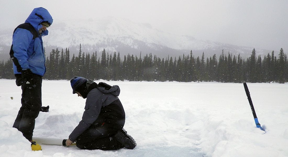
Radiocarbon dates, pollen, macrofossils and DNA revealed how ecosystem developed The conclusion reached by Willerslev and his colleagues is that the journey would have been impossible until about 12,600 years ago. Their research focused on a “bottleneck,” one of the last parts of the corridor to become ice-free, and now partly covered by Charlie Lake in British Columbia, and Spring Lake, Alberta — both part of Canada’s Peace River drainage basin.
The team gathered evidence — including radiocarbon dates, pollen, macrofossils and DNA taken from lake sediment cores — which they obtained standing on the frozen lake surface during the winter season. Willerslev’s own PhD, 13 years ago, demonstrated that it is possible to extract ancient plant and mammalian DNA from sediments, as it contains preserved molecular fossils from substances such as tissue, urine and feces.
Having acquired the DNA, the group then applied a technique termed “shotgun sequencing.”
“Instead of looking for specific pieces of DNA from individual species, we basically sequenced everything in there, from bacteria to animals,” Willerslev said. “It’s amazing what you can get out of this. We found evidence of fish, eagles, mammals and plants. It shows how effective this approach can be to reconstruct past environments.”
This approach allowed the team to see, with remarkable precision, how the bottleneck’s ecosystem developed. Crucially, it showed that before about 12,600 years ago, there were no plants, nor animals, in the corridor, meaning that humans passing through it would not have had resources vital to survive.
Clovis could not have travelled through ice-free corridor as previously believed Around 12,600 years ago, steppe vegetation started to appear, followed quickly by animals such as bison, woolly mammoth, jackrabbits and voles. Importantly 11,500 years ago, the researchers identified a transition to a “parkland ecosystem” – a landscape densely populated by trees, as well as moose, elk and bald-headed eagles, which would have offered crucial resources for migrating humans.
Somewhere in between, the lakes in the area were populated by fish, including several identifiable species such as pike and perch. Finally, about 10,000 years ago, the area transitioned again, this time into boreal forest, characterized by spruce and pine.
The fact that Clovis was clearly present south of the corridor before 12,600 years ago means that they could not have travelled through it.
“Most likely, you would say that the evidence points to their having travelled down the Pacific Coast,” Willerslev added. “That now seems the most likely scenario.”
CT scans offer new insight into the little-understood Pawpawsaurus: One clue that led the researchers to determine that the sense of smell was Pawpawsaurus’s strongest sense was the large olfactory ratio.
A Texas native from what is now Tarrant County, Pawpawsaurus lived 100 million years ago, making its home along the shores of an inland sea that split North America from Texas northward to the Arctic Sea.
The Laser Beats Rock article published July 25, 2016.
Pawpawsaurus campbelli is the prehistoric cousin of the well-known armored dinosaur Ankylosaurus, famous for a hard knobby layer of bone across its back and a football-sized club on its tail.
Jacobs, a world-renowned vertebrate paleontologist, joined SMU’s faculty in 1983 and in 2012 was honored by the 7,200-member Science Teachers Association of Texas with their prestigious Skoog Cup for his significant contributions to advance quality science education.
By Sarah Puschmann
Laser Beats Rock
In 1819, the German naturalist Lorenz Oken found something astonishing inside a pterodactyl’s broken skull: petrified mud in the form of the long deceased dinosaur’s brain, so well molded into the crevices as to reveal the brain’s two distinct halves.
This so-called “fossil brain” is one of the first known instances of a cranial endocast, an internal cast of the skull that makes the impressions of the decayed soft tissue visible. For paleoneurologists not lucky enough to uncover a natural endocast, some have opted to slice open skulls and made molds using liquid latex rubber or plaster of Paris.
But cutting open a skull for study isn’t always an option, particularly if it is a holotype, the singular specimen used to define a species for the first time. This is the case for the 100 million year old skull from a dinosaur called Pawpawsaurus campbelli studied by Ariana Paulina-Carabajal of the National Research Council of Argentina (CONICET) and the Institute of Investigations in Biodiversity and the Environment (INIBIOMA) and her team, led by Louis Jacobs.
By CT scanning the skull, it was possible to make important insights about the dinosaur’s olfaction and hearing while leaving the precious holotype intact. Their analysis led the researchers to conclude that smell was the sense Pawpawsaurus most likely relied on most, as reported in the journal PLOS ONE.
This is valuable information, especially because so little is known about this dinosaur. What is known is that the four-legged herbivore most likely had long spines on its shoulders and neck, as was the case for other members of the same family of nodosaurids. It also probable that Pawpawsaurus wasn’t endowed with the knob of bone in its tail characteristic of ankylosaurids, a related dinosaur family, nor did it experience the satisfaction of slamming a club tail against, well, anything. (Was there such a thing as tail envy?)
If the hole dramatically expands, “Wink will have some beachfront property,” Keely jokes. “Somebody’s going to make a marina out of it.” — Winkler County Sheriff George Keely to The Texas Tribune.
The Dedman College geophysicists are co-authors of a new analysis using satellite radar images to reveal ground movement of two giant sinkholes near Wink, Texas. They found that the movement suggests the two existing holes are expanding, and new ones are forming as nearby subsidence occurs at an alarming rate.
Lu is world-renowned for leading scientists in InSAR applications, short for a technique called interferometric synthetic aperture radar, to detect surface changes that aren’t visible to the naked eye. Lu is a member of the Science Definition Team for the dedicated U.S. and Indian NASA-ISRO InSAR mission, set for launch in 2020 to study hazards and global environmental change.
Request an interview
To request an interview with Zhong Lu call SMU News and Communications at 214-768-7650 or email SMU News at news@smu.edu.
Request an interview
To request an interview with Jin-woo Kim call SMU News and Communications at 214-768-7650 or email SMU News at news@smu.edu.
InSAR accesses a series of images captured by a read-out radar instrument mounted on the orbiting satellite Sentinel-1A. Sentinel-1A was launched in April 2014 as part of the European Union’s Copernicus program.
By Jim Malewitz
The Texas Tribune
WINK — Sheriff George Keely’s truck bobbed as he cruised down a particularly warped and cracked stretch of county road.
“This is the road I don’t like to drive on if I don’t have to,” he said as brown-green West Texas scrubland reflected in the rearview mirror. The trip is riskier than he’d like.
But here was Keely — a few months away from retirement after more than 20 years as a Winkler County lawman, five of them as sheriff — again escorting a reporter and photographer across the unstable terrain toward the Wink Sinks, the community’s chasms of fascination and fear.
The two gaping sinkholes, which sit between the small towns of Wink and Kermit atop the largely tapped out Hendrick oilfield, aren’t new. Wink Sink No. 1 — more than a football field across and 100 feet deep when it collapsed — turned 36 years old last month. Its more massive cousin to the south, Wink Sink No.2, swallowed a water well, pipelines and surrounding desert back in 2002.
A recent study by two Southern Methodist University geophysicists has thrust the sinkholes back into conversations here and across the wider realm of social media.
The research, published last month in the peer-reviewed journal Remote Sensing, used satellite imagery to chart what other researchers and folks like Keely have noticed: the sinkholes keep growing, and land surrounding them is sinking — likely due to a mix of geology and human intervention.
The instability raises the possibility that more abysses could open without further notice, the SMU researchers suggested.
“A collapse could be catastrophic,” research scientist Jin-Woo Kim said in a statement upon the study’s release.
“I would be very concerned,” his partner Zhong Lu, a professor, said in an interview.
Those findings quickly garnered attention from news media across Texas and the U.S. and other websites. The headlines grew more alarming and less accurate as blogs and other websites aggregated and re-aggregated the news. (“Giant Sinkholes Threaten to Swallow Two Tiny West Texas Towns,” “Sinkholes May Take Texas Down”).
In Winkler County, the prognostications were greeted largely with a yawn.
SMU is a nationally ranked private university in Dallas founded 100 years ago. Today, SMU enrolls nearly 11,000 students who benefit from the academic opportunities and international reach of seven degree-granting schools. For more information, www.smu.edu.
SMU has an uplink facility located on campus for live TV, radio, or online interviews. To speak with an SMU expert or book an SMU guest in the studio, call SMU News & Communications at 214-768-7650.


 To request an interview with Zhong Lu call SMU News and Communications at 214-768-7650 or email SMU News at
  To request an interview with Jin-woo Kim call SMU News and Communications at 214-768-7650 or email SMU News at
 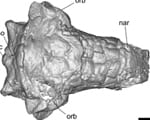 Early armored dino from Texas lacked cousin’s club-tail weapon, but had a nose for danger
 SMU physicists: CERN’s Large Hadron Collider is once again smashing protons, taking data
 Nearby massive star explosion 30 million years ago equaled brightness of 100 million suns
 Text in lost language may reveal god or goddess worshipped by Etruscans at ancient temple
 Good news! You’re likely burning more calories than you thought