Categories
Earth & Climate Researcher news SMU In The News Technology

KERA News: Near Wink, Texas, The Sink Holes Are Getting Bigger And Bigger

“’We could have another sink hole or two or 10 someday show up,’” (Winkler County Sheriff George) Keely says. In fact, the SMU researchers used satellite imaging to show the problem is getting worse.”

KERA public radio news covered the research of SMU geophysicists Zhong Lu, professor, Shuler-Foscue Chair, and Jin-Woo Kim research scientist, both in the Roy M. Huffington Department of Earth Sciences at SMU.

KERA’s article, “Near Wink, Texas, The Sink Holes Are Getting Bigger And Bigger,” aired June 28, 2016.

The Dedman College faculty are co-authors of a new analysis using satellite radar images to reveal ground movement of two giant sinkholes near Wink, Texas. They found that the movement suggests the two existing holes are expanding, and new ones are forming as nearby subsidence occurs at an alarming rate.

Lu is world-renowned for leading scientists in InSAR applications, short for a technique called interferometric synthetic aperture radar, to detect surface changes that aren’t visible to the naked eye.

Lu is a member of the Science Definition Team for the dedicated U.S. and Indian NASA-ISRO InSAR mission, set for launch in 2020 to study hazards and global environmental change.

InSAR accesses a series of images captured by a read-out radar instrument mounted on the orbiting satellite Sentinel-1A. Sentinel-1A was launched in April 2014 as part of the European Union’s Copernicus program.

Lu and Kim reported the findings in the scientific journal Remote Sensing, in the article “Ongoing deformation of sinkholes in Wink, Texas, observed by time-series Sentinel-1A SAR Interferometry.”

The research was supported by the U.S. Geological Survey Land Remote Sensing Program, the NASA Earth Surface & Interior Program, and the Shuler-Foscue Endowment at Southern Methodist University.

Read the full story.

EXCERPT:

KERA Public Radio News
The earth is crumbling in West Texas. Scientists from Southern Methodist University have new research that shows two massive sinkholes between the towns of Wink and Kermit are expanding.

Years of drilling for oil and gas have helped wash away salt beds underneath the ground. A shifting water table has made the problem worse and in some places the ground is sinking five inches a year, according to the satellite readings.

Now there’s concern the pits could converge into one giant hole. “A collapse could be catastrophic,” SMU research scientist Jin-Woo Kim said.

These wounds in the West Texas desert have been around for years. The first hole opened up near an abandoned oil well on June 3, 1980. Twenty-two years later, about a mile away, the second one appeared. From the sky, they look like high-caliber bullet holes

“It’s pretty scary. It’s just a big huge pit,” said Winkler County Sheriff George Keely, who has peered over the edge many times in his career. “It’s like standing on the moon looking into a crater. And you can see where it’s just caved off. It’s broken off over the years more and more. When you look down there, you’re looking at water.”

Water is the problem. West Texas, not far from Odessa, is oil country. Drillers started working near

Wink in the mid-1920s. For decades, they injected water into the ground and destabilized the earth, according to the researchers. Meanwhile, as the water table shrinks, thick layers of salt are dissolved far below the surface.

It’s like kicking the legs out from underneath a chair.

Read the full story.

Categories
Earth & Climate Fossils & Ruins Plants & Animals Researcher news SMU In The News

KERA: Thanks To CT Scans, Scientists Know A Lot About Texas’ Pawpawsaurus Dinosaur

“There’s no relationship between dinosaurs and armadillos, which are mammals, but it is interesting that something that looked like an armadillo was here in Texas 100 million years before highways.” — Jacobs

KERA public radio journalist Justin Martin covered the research of SMU Earth Sciences Professor Louis L. Jacobs in a KERA interview “Thanks To CT Scans, Scientists Know A Lot About Texas’ Pawpawsaurus Dinosaur.”

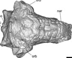
A professor in Dedman College‘s Roy M. Huffington Department of Earth Sciences, Jacobs is co-author of a new analysis of the Cretaceous Period dinosaur Pawpawsaurus based on the first CT scans ever taken of the dinosaur’s skull.

A Texas native from what is now Tarrant County, Pawpawsaurus lived 100 million years ago, making its home along the shores of an inland sea that split North America from Texas northward to the Arctic Sea.

The KERA interview was aired June 29, 2016.

Pawpawsaurus campbelli is the prehistoric cousin of the well-known armored dinosaur Ankylosaurus, famous for a hard knobby layer of bone across its back and a football-sized club on its tail.

Jacobs, a world-renowned vertebrate paleontologist, joined SMU’s faculty in 1983 and in 2012 was honored by the 7,200-member Science Teachers Association of Texas with their prestigious Skoog Cup for his significant contributions to advance quality science education.

Jacobs is president of SMU’s Institute for the Study of Earth and Man.

Hear the KERA segment.

EXCERPT:

By Justin Martin
KERA

CT scans aren’t just for people — they can also be used on dinosaurs.

A skull from the Pawpawsaurus was discovered in North Texas in the early ’90s. It was recently scanned, allowing scientists to digitally rebuild the dinosaur’s brain. Louis Jacobs is a professor of paleontology at SMU and he talks about his research.

Interview Highlights: Louis Jacobs …

… on the reason behind the name Pawpawsaurus: “It was named Pawpawsaurus because the rock unit that it was found in is called the Pawpaw formation and that’s in Fort Worth.”

… on what the CT scan uncovered: “Basically, a CT scan, you are X-raying through the body and then you can make 3D digital models of what’s recorded. We do it with humans and medicine all the time, but dinosaurs and fossils require more energy. So, the X-rays are put through with more energy and you can get a good model.”

… on how you go from scanning to rebuilding a brain: “Visualization through software is … you can see inside the Earth, you can see inside the clouds, you can see inside people, you can see inside everything. The advances in the software make digital visualization accessible. We had the data from scanning the skull of Pawpawsaurus and then from that we rendered 3D models of the brain and also the nasal passages to figure out how the air went through.

Hear the KERA segment.

Categories
Earth & Climate Fossils & Ruins Researcher news SMU In The News Technology

Seeker.com: Giant Sinkholes Near Texas Oil Fields Are Growing

New holes are also developing to join them, a satellite study shows.

Wink sinkholes

Online news site Seeker.com covered the research of SMU geophysicists Zhong Lu, professor, Shuler-Foscue Chair, and Jin-Woo Kim research scientist, both in the Roy M. Huffington Department of Earth Sciences at SMU. Seeker.com’s article, “Giant Sinkholes Near Texas Oil Fields Are Growing,” published June 16, 2016.

The Dedman College geophysicists are co-authors of a new analysis using satellite radar images to reveal ground movement of two giant sinkholes near Wink, Texas. They found that the movement suggests the two existing holes are expanding, and new ones are forming as nearby subsidence occurs at an alarming rate.

Lu is world-renowned for leading scientists in InSAR applications, short for a technique called interferometric synthetic aperture radar, to detect surface changes that aren’t visible to the naked eye. Lu is a member of the Science Definition Team for the dedicated U.S. and Indian NASA-ISRO InSAR mission, set for launch in 2020 to study hazards and global environmental change.

InSAR accesses a series of images captured by a read-out radar instrument mounted on the orbiting satellite Sentinel-1A. Sentinel-1A was launched in April 2014 as part of the European Union’s Copernicus program.

Lu and Kim reported the findings in the scientific journal Remote Sensing, in the article “Ongoing deformation of sinkholes in Wink, Texas, observed by time-series Sentinel-1A SAR Interferometry.”

The research was supported by the U.S. Geological Survey Land Remote Sensing Program, the NASA Earth Surface & Interior Program, and the Shuler-Foscue Endowment at Southern Methodist University.

Read the full story.

EXCERPT:

Seeker.com
In west Texas, they call them the “Wink Sinks.” They’re two giant sinkholes between the towns of Wink and Kermit, the after-affect of a lot of oil being pumped out of the ground in the area more than 60 years ago. And now researchers have discovered that the oddball landmarks — already the size of multiple football fields — are unstable and likely to grow even bigger.

Southern Methodist University geophysicists utilized a time series of radar images captured by an orbiting satellite 435 miles overhead to study the sinkholes. They used a technique called interferometric synthetic aperture radar, or InSAR, to detect changes that aren’t visible to a person at ground level.

Their study, published in the journal Remote Sensing, found that the extent of subsidence in the area has increased significantly over the past seven years, and that the instability originally caused by oil drilling now is being driven by changing groundwater levels.

As the groundwater increases, it dissolves a massive underground salt formation in the area, which then causes the ground to sink.

That’s a problem, because the Wink Sinks already are pretty big. Wink Sink No. 1, which is closer to the town of Kermit, has grown since 1980 to 361 feet across. Wink Sink No. 2, which is nine-tenths of a mile to the south, is about 900 feet across at its widest point.

But to make matters worse, other parts of the area around the sinkholes is sinking as well. The highest rate of ground subsidence is in an area about seven-tenths of a mile northeast of No. 2, which is collapsing at a rate of more than 5 inches per year.

“This area is heavily populated with oil and gas production equipment and installations, hazardous liquid pipelines, as well as two communities,” research scientist Jin-Woo Kim, who co-authored the study with SMU professor Zhong Lu, explained in a press release. He explained that a more massive collapse “could be catastrophic.”

Read the full story.

Follow SMU Research on Twitter, @smuresearch.

For more SMU research see www.smuresearch.com.

SMU is a nationally ranked private university in Dallas founded 100 years ago. Today, SMU enrolls nearly 11,000 students who benefit from the academic opportunities and international reach of seven degree-granting schools. For more information, www.smu.edu.

SMU has an uplink facility located on campus for live TV, radio, or online interviews. To speak with an SMU expert or book an SMU guest in the studio, call SMU News & Communications at 214-768-7650.

Categories
Earth & Climate Fossils & Ruins Researcher news SMU In The News Technology

Star-Telegram: Two giant sinkholes in West Texas expanding, researchers say

“They’re a ways off from the highway; if nobody mentions it, then nobody is interested in it,” Kermit City Manager Gloria Saenz told the New York Daily News.

Wink sinkholes

Fort Worth Star-Telegram journalist Tom Uhler covered the research of SMU geophysicists Zhong Lu, professor, Shuler-Foscue Chair, and Jin-Woo Kim research scientist, both in the Roy M. Huffington Department of Earth Sciences at SMU. Uhler’s article, “Two giant sinkholes in West Texas expanding, researchers say,” published June 16, 2016.

The Dedman College geophysicists are co-authors of a new analysis using satellite radar images to reveal ground movement of two giant sinkholes near Wink, Texas. They found that the movement suggests the two existing holes are expanding, and new ones are forming as nearby subsidence occurs at an alarming rate.

Lu is world-renowned for leading scientists in InSAR applications, short for a technique called interferometric synthetic aperture radar, to detect surface changes that aren’t visible to the naked eye. Lu is a member of the Science Definition Team for the dedicated U.S. and Indian NASA-ISRO InSAR mission, set for launch in 2020 to study hazards and global environmental change.

InSAR accesses a series of images captured by a read-out radar instrument mounted on the orbiting satellite Sentinel-1A. Sentinel-1A was launched in April 2014 as part of the European Union’s Copernicus program.

Lu and Kim reported the findings in the scientific journal Remote Sensing, in the article “Ongoing deformation of sinkholes in Wink, Texas, observed by time-series Sentinel-1A SAR Interferometry.”

The research was supported by the U.S. Geological Survey Land Remote Sensing Program, the NASA Earth Surface & Interior Program, and the Shuler-Foscue Endowment at Southern Methodist University.

Read the full story.

EXCERPT:

By Tom Uhler
Star-Telegram

A couple of giant sinkholes in the West Texas oil patch are apparently expanding, and might eventually converge into one gigantic hole.

The sinkholes are about a mile apart and sit between Wink and Kermit off I-20 west of Midland-Odessa. They were caused by lots of oil and gas extraction, which peaked from the mid-1920s to the mid-1960s, according to researchers at Southern Methodist University.

Satellite radar images indicate that the giant sinkholes are expanding and that new ones are forming “at an alarming rate” as nearby subsidence occurs, they report in the scientific journal Remote Sensing. One is 361 feet across, about the size of a football field; the other is larger, 670 to 900 feet across.

“A collapse could be catastrophic,” said geophysicist Jin-Woo Kim, who leads the SMU geophysical team reporting the findings.

In addition to Wink and Kermit (combined pop. about 7,000), there’s lots of oil and gas production equipment and installations and hazardous liquid pipelines in the area, Kim said in the report. The fresh water injected underground in the extraction process “can dissolve the interbedded salt layers and accelerate the sinkhole collapse.”

There’s something not too dissimilar happening in Daisetta, east of Houston.

Officials have fenced off the area around the sinkholes between Wink and Kermit and they’ll be monitored, but residents don’t appear to be worried about them.

“They’re a ways off from the highway; if nobody mentions it, then nobody is interested in it,” Kermit City Manager Gloria Saenz told the New York Daily News.

A preacher of the Apocalypse from Indiana had a decidedly different take, exclaiming on YouTube: “Here’s my concern. It’s like hell is being enlarged, and that without measure.”

Well, maybe not quite.

Read the full story.

Follow SMU Research on Twitter, @smuresearch.

For more SMU research see www.smuresearch.com.

SMU is a nationally ranked private university in Dallas founded 100 years ago. Today, SMU enrolls nearly 11,000 students who benefit from the academic opportunities and international reach of seven degree-granting schools. For more information, www.smu.edu.

SMU has an uplink facility located on campus for live TV, radio, or online interviews. To speak with an SMU expert or book an SMU guest in the studio, call SMU News & Communications at 214-768-7650.

Categories
Earth & Climate Fossils & Ruins Researcher news SMU In The News Technology

New York Daily News: Giant sinkholes in Texas are growing, may collide: study

The sinkholes are a little less than a mile apart, but that distance is closing as the land directly around both holes subsides about 2 inches each year.

Wink sinkholes

New York Daily News journalist Anthony Izaguirre covered the research of SMU geophysicists Zhong Lu, professor, Shuler-Foscue Chair, and Jin-Woo Kim research scientist, both in the Roy M. Huffington Department of Earth Sciences at SMU. Izaguirre’s article, “Giant sinkholes in Texas are growing, may collide: study,” published June 16, 2016.

The Dedman College geophysicists are co-authors of a new analysis using satellite radar images to reveal ground movement of two giant sinkholes near Wink, Texas. They found that the movement suggests the two existing holes are expanding, and new ones are forming as nearby subsidence occurs at an alarming rate.

Lu is world-renowned for leading scientists in InSAR applications, short for a technique called interferometric synthetic aperture radar, to detect surface changes that aren’t visible to the naked eye. Lu is a member of the Science Definition Team for the dedicated U.S. and Indian NASA-ISRO InSAR mission, set for launch in 2020 to study hazards and global environmental change.

InSAR accesses a series of images captured by a read-out radar instrument mounted on the orbiting satellite Sentinel-1A. Sentinel-1A was launched in April 2014 as part of the European Union’s Copernicus program.

Lu and Kim reported the findings in the scientific journal Remote Sensing, in the article “Ongoing deformation of sinkholes in Wink, Texas, observed by time-series Sentinel-1A SAR Interferometry.”

The research was supported by the U.S. Geological Survey Land Remote Sensing Program, the NASA Earth Surface & Interior Program, and the Shuler-Foscue Endowment at Southern Methodist University.

Read the full story.

EXCERPT:

By Anthony Izaguirre
New York Daily News

Two massive, rapidly expanding sinkholes in Texas are at risk of collapsing into each other and causing a “catastrophic” natural disaster, scientists warned.

Geophysicists at Southern Methodist University found that the land around the gaping sinkholes between the west Texas towns of Wink and Kermit is deteriorating — which could end up either forming more holes or creating one giant sinkhole.

These sinkholes, which were caused by the area’s oil and gas extraction industries, are nothing new to Texas residents.

The first hole, Wink Sink #1, opened up in 1980 and is currently about as wide as a football field.

Wink Sink #2, the larger of the two holes, opened in 2002 and stretches for 900 feet at its widest point.

The sinkholes are a little less than a mile apart, but that distance is closing as the land directly around both holes subsides about 2 inches each year.

“This area is heavily populated with oil and gas production equipment and installations, hazardous liquid pipelines, as well as two communities,” Jin-Woo Kim, a coauthor of the report, said in a statement. “A collapse could be catastrophic.”

Read the full story.

Follow SMU Research on Twitter, @smuresearch.

For more SMU research see www.smuresearch.com.

SMU is a nationally ranked private university in Dallas founded 100 years ago. Today, SMU enrolls nearly 11,000 students who benefit from the academic opportunities and international reach of seven degree-granting schools. For more information, www.smu.edu.

SMU has an uplink facility located on campus for live TV, radio, or online interviews. To speak with an SMU expert or book an SMU guest in the studio, call SMU News & Communications at 214-768-7650.