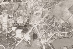
SMU’s CUL Digital Collections has made available the Dallas Aerial Photographs, 1945 USDA Survey. This online collection complements the Dallas Historic Aerial Photographs, 1930 Fairchild Survey.
There are 16 pairs of images in the Dallas Aerial Photographs, USDA 1945 Survey digital collection that portray various locations in the Dallas metropolitan area as well as Irving, Grand Prairie, and Hutchins. The original photographs were taken by the Army Air Forces for the United States Department of Agriculture and were developed by the Western Aerial Photographic Laboratory in Salt Lake City, Utah. The purpose of the photographs was to survey farmland, which covered large portions of the Dallas area at the time.
The aerial survey collection is housed in the Edwin J. Foscue Map Library. The library worked with regional historian George Cearley to identify important features in the photographs such as major roads, railways, and landmarks. In the digital collection, there are two versions of each image, labeled and unlabeled. Labeled images include markers that correspond to a legend that appears below the image.

The United States Department of Agriculture’s Farm Security Agency created aerial photographs as a means of surveying farmland. The practice of surveying began shortly after the 1933 Agricultural Adjustment Act introduced programs that would require farmers to provide accurate measurements in order to participate. Farm programs were designed to stabilize prices, arbitrate mortgage agreements, and insure loans for rural housing and business. Originally, surveying was done by placing chains around fields and creating hand drawn maps. By the 1940s, aerial photography was used as a more efficient and accurate method, and the USDA created two aerial photography labs, one in Asheville, North Carolina, and the other in Salt Lake City, Utah (which developed this set of images). USDA aerial photography was consolidated to the Aerial Photography Field Office (APFO) in Salt Lake City in 1976.