Categories
Earth & Climate Energy & Matter Feature Fossils & Ruins Researcher news

SMU study finds earthquakes continue for years after gas field wastewater injection stops

High rates of injection and large volumes can perturb critically stressed faults, triggering earthquakes years after wastewater wells are shut in.

Efforts to stop human-caused earthquakes by shutting down wastewater injection wells that serve adjacent oil and gas fields may oversimplify the challenge, according to a new study from seismologists at Southern Methodist University, Dallas.

The seismologists analyzed a sequence of earthquakes at DFW Airport and found that even though wastewater injection was halted after a year, the earthquakes continued.

The sequence of quakes began in 2008, and wastewater injection was halted in 2009. But earthquakes continued for at least seven more years.

“This tells us that high-volume injection, even if it’s just for a short time, when it’s near a critically stressed fault, can induce long-lasting seismicity,” said SMU seismologist Paul O. Ogwari, who developed a unique method of data analysis that yielded the study results.

The earthquakes may be continuing even now, said Ogwari, whose analysis extended through 2015.

The study’s findings indicate that shutting down injection wells in reaction to earthquakes, as some states such as Oklahoma and Arkansas are doing, may not have the desired effect of immediately stopping further earthquakes, said seismologist Heather DeShon, a co-author on the study and an associate professor in the SMU Earth Sciences Department.

“The DFW earthquake sequence began on Halloween in 2008 — before Oklahoma seismicity rates had notably increased,” said DeShon. “This study revisits what was technically the very first modern induced earthquake sequence in this region and shows that even though the wastewater injector in this case had been shut off very quickly, the injection activity still perturbed the fault, so that generated earthquakes even seven years later.”

That phenomenon is not unheard of. Seismologists saw that type of earthquake response from a rash of human-induced earthquakes in Colorado after wastewater injection during the 1960s at the Rocky Mountain Arsenal near Denver. Similarly in that case, injection was started and stopped, but earthquakes continued.

Such a possibility has not been well understood outside scientific circles, said DeShon. She is a member of the SMU seismology team that has studied and published extensively on their scientific findings related to the unusual spate of human-induced earthquakes in North Texas.

“The perception is that if the oil and gas wastewater injectors are leading to this, then you should just shut the injection wells down,” DeShon said. “But Paul’s study shows that there’s a lot to be learned about the physics of the process, and by monitoring continuously for years.”

Ogwari, DeShon and fellow SMU seismologist Matthew J. Hornbach reported the findings in the peer-reviewed Journal of Geophysical Research in the article “The Dallas-Fort Worth Airport Earthquake Sequence: Seismicity Beyond Injection Period.”

Known DFW Airport quakes number more than 400
The DFW Airport’s unprecedented earthquake clusters were the first ever documented in the history of the North Texas region’s oil-rich geological system known as the Fort Worth Basin. The quakes are also the first of multiple sequences in the basin tied to large-scale subsurface disposal of waste fluids from oil and gas operations.

The DFW Airport earthquakes began in 2008, as did high-volume wastewater injection of brine. Most of the seismic activity occurred in the first two months after injection began, primarily within .62 miles, or 1 kilometer, from the well. Other clusters then migrated further to the northeast of the well over the next seven years. The quakes were triggered on a pre-existing regional fault that trends 3.7 miles, or 6 kilometers, northeast to southwest.

Ogwari, a post-doctoral researcher in the SMU Roy M. Huffington Earth Sciences Department in Dedman College, analyzed years of existing seismic data from the region to take a deeper look at the DFW Airport sequence, which totaled 412 earthquakes through 2015.

Looking at the data for those quakes, Ogwari discovered that they had continued for at least seven years into 2015 along 80% of the fault, even though injection was stopped after only 11 months in August of 2009.

Rate of quakes declined, but magnitude has never lessened
In another important finding from the study, Ogwari found that the magnitude of the DFW Airport earthquakes didn’t lessen over time, but instead held steady. Magnitude ranged from 0.5 to 3.4, with the largest one occurring three years after injection at the well was stopped.

“What we’ve seen here is that the magnitude is consistent over time within the fault,” Ogwari said. “We expect to see the bigger events during injection or immediately after injection, followed by abrupt decay. But instead we’re seeing the fault continue to produce earthquakes with similar magnitudes that we saw during injection.”

While the rate of earthquakes declined — there were 23 events a month from 2008 to 2009, but only 1 event a month after May 2010 — the magnitude stayed the same. That indicates the fault doesn’t heal completely.

“We don’t know why that is,” Ogwari said. “I think that’s a question that is out there and may need more research.”

More monitoring needed for human-induced quakes
Answering that question, and others, about the complex characteristics and behavior of faults and earthquakes, requires more extensive monitoring than is currently possible given the funding allotted to monitor quakes.

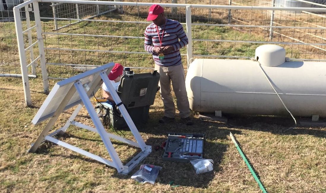
Monitoring the faults involves strategically placed stations that “listen” and record waves of intense energy echoing through the ground, DeShon said.

The Fort Worth Basin includes the Barnett shale, a major gas producing geological formation, atop the deep Ellenberger formation used for wastewater storage, which overlays a granite basement layer. The ancient Airport fault system extends through all units.

Friction prevented the fault from slipping for millions of years, but in 2008 high volumes of injected wastewater disturbed the Airport fault. That caused the fault to slip, releasing stored-up energy in waves. The most powerful waves were “felt” as the earth shaking.

“The detailed physical equations relating wastewater processes to fault processes is still a bit of a question,” DeShon said. “But generally the favored hypothesis is that the injected fluid changes the pressure enough to change the ratio of the downward stress to the horizontal stresses, which allows the fault to slip.”

Earthquakes in North Texas were unheard of until 2008, so when they began to be felt, seismologists scrambled to install monitors. When the quakes died down, the monitoring stations were removed.

“As it stands now, we miss the beginning of the quakes. The monitors are removed when the earthquakes stop being felt,” DeShon said. “But this study tells us that there’s more to it than the ‘felt’ earthquakes. We need to know how the sequences start, and also how they end. If we’re ever going to understand what’s happening, we need the beginning, the middle — and the end. Not just the middle, after they are felt.”

Innovative method tapped for studying earthquake activity
Monitors the SMU team installed at the DFW Airport were removed when seismic activity appeared to have died down in 2009.

Ogwari hypothesized he could look at historical data from distant monitoring stations still in place to extract information and document the history of the DFW Airport earthquakes.

The distant stations are a part of the U.S. permanent network monitored and maintained by the U.S. Geological Survey. The nearest one is 152 miles, 245 kilometers, away.

Earthquake waveforms, like human fingerprints, are unique. Ogwari used the local station monitoring data to train software to identify DFW earthquakes on the distant stations. Ogwari took each earthquake’s digital fingerprint and searched through years of data, cross-correlating waveforms from both the near and regional stations and identified the 412 DFW Airport events.

“The earthquakes are small, less than magnitude three,” DeShon said. “So on the really distant stations it’s like searching for a needle in a haystack, sifting them from all the other tiny earthquakes happening all across the United States.”

Each path is unique for every earthquake, and seismologists record each wave’s movement up and down, north to south, and east to west. From that Ogwari analyzed the evolution of seismicity on the DFW airport fault over space and time. He was able to look at data from the distant monitors and find seismic activity at the airport as recent as 2015.

“Earthquakes occurring close in space usually have a higher degree of similarity,” Ogwari said. “As the separation distance increases the similarity decreases.”

To understand the stress on the fault, the researchers also modeled the location and timing of the pressure in the pores of the rock as the injected water infiltrated.

For the various earthquake clusters, the researchers found that pore pressure increased along the fault at varying rates, depending on how far the clusters were from the injection well, the rate and timing of injection, and hydraulic permeability of the fault.

The analysis showed pore-pressure changes to the fault from the injection well where the earthquakes started in 2008; at the location of the May 2010 quakes along the fault; and at the northern edge of the seismicity.

Will the DFW Airport fault continue to slip and trigger earthquakes?

“We don’t know,” Ogwari said. “We can’t tell how long it will continue. SMU and TexNet, the Texas Seismic Network, continue to monitor both the DFW Airport faults and other faults in the Basin.” — Margaret Allen, SMU

Categories
Earth & Climate Energy & Matter Researcher news SMU In The News

Scientific American: Drilling Reawakens Sleeping Faults in Texas, Leads to Earthquakes

For 300 million years faults showed no activity, and then wastewater injections from oil and gas wells came along. Study authors took a different approach in the new work — they hunted for deformed faults below Texas.

Science journalist Anna Kuchment covered the landmark earthquake research of a team of SMU geophysicists led by SMU Associate Professor Beatrice Magnani in the SMU Department of Earth Sciences. Kuchment wrote Drilling Reawakens Sleeping Faults in Texas, Leads to Earthquakes for Scientific American.

The SMU researchers tapped seismic data to analyze earthquakes in Texas over the past decade.

The results of the analysis showed that human activity is causing the earthquakes as a result of movement in faults that have been silent for at least 300 million years, until recent injection of oil and gas wastewater.

The article by Kuchment, “Drilling Reawakens Sleeping Faults in Texas, Leads to Earthquakes,” published Nov. 24, 2017.

Read the full story.

EXCERPT:

By Anna Kuchment
Scientific American

Since 2008, Texas, Oklahoma, Kansas and a handful of other states have experienced unprecedented surges of earthquakes. Oklahoma’s rate increased from one or two per year to more than 800. Texas has seen a sixfold spike. Most have been small, but Oklahoma has seen several damaging quakes stronger than magnitude 5. While most scientists agree that the surge has been triggered by the injection of wastewater from oil and gas production into deep wells, some have suggested these quakes are natural, arising from faults in the crust that move on their own every so often. Now researchers have traced 450 million years of fault history in the Dallas-Fort Worth area and learned these faults almost never move. “There hasn’t been activity along these faults for 300 million years,” says Beatrice Magnani, a seismologist at Southern Methodist University in Dallas and lead author of a paper describing the research, published today in Science Advances. “Geologically, we usually define these faults as dead.”

Magnani and her colleagues argue that these faults would not have produced the recent earthquakes if not for wastewater injection. Pressure from these injections propagates underground and can disturb weak faults. The work is another piece of evidence implicating drilling in the quakes, yet the Texas government has not officially accepted the link to one of its most lucrative industries.

Magnani and her colleagues studied the Texas faults using images of the subsurface similar to ultrasound scans. Known as seismic reflection data, the images are created by equipment that generates sound waves and records the speeds at which the waves bounce off faults and different rock layers deep within the ground. Faults that have produced earthquakes look like vertical cracks in a brick wall, where one side of the wall has sunk down a few inches so the rows of bricks no longer line up. Scientists know the age of each rock layer—each row of bricks–based on previous studies that have used a variety of dating techniques.

Read the full story.

Categories
Earth & Climate Energy & Matter Feature Researcher news

SMU seismology research shows North Texas earthquakes occurring on “dead” faults

Study by Beatrice Magnani, USGS and other SMU scientists shows recent seismicity in Fort Worth Basin occurred on faults not active for 300 million years

Recent earthquakes in the Fort Worth Basin — in the rural community of Venus and the Dallas suburb of Irving – occurred on faults that had not been active for at least 300 million years, according to research led by SMU seismologist Beatrice Magnani.

The research supports the assertion that recent North Texas earthquakes were induced, rather than natural – a conclusion entirely independent of previous analyses correlating seismicity to the timing of wastewater injection practices, but that corroborates those earlier findings.

The full study, “Discriminating between natural vs induced seismicity from long-term deformation history of intraplate faults,” was published online Nov. 24, 2017 by the journal Science Advances.

“To our knowledge this is the first study to discriminate natural and induced seismicity using classical structural geology analysis techniques,” said Magnani, associate professor of geophysics in SMU’s Huffington Department of Earth Sciences. Co-authors for the study include Michael L. Blanpied, associate coordinator of the USGS Earthquake Hazard program, and SMU seismologists Heather DeShon and Matthew Hornbach.

The results were drawn from analyzing the history of fault slip (displacement) over the lifetime of the faults. The authors analyzed seismic reflection data, which allow “mapping” of the Earth’s subsurface from reflected, artificially generated seismic waves. Magnani’s team compared data from the North Texas area, where several swarms of felt earthquakes have been occurring since 2008, to data from the Midwestern U.S. region that experienced major earthquakes in 1811 and 1812 in the New Madrid seismic zone.

Frequent small earthquakes are still recorded in the New Madrid seismic zone, which is believed to hold the potential for larger earthquakes in the future.

“These North Texas faults are nothing like the ones in the New Madrid Zone – the faults in the Fort Worth Basin are dead,” Magnani said. “The most likely explanation for them to be active today is because they are being anthropogenically induced to move.”

In the New Madrid seismic zone, the team found that motion along the faults that are currently active has been occurring over many millions of years. This has resulted in fault displacements that grow with increasing age of sedimentary formations.

In the Fort Worth Basin, along faults that are currently seismically active, there is no evidence of prior motion over the past 300 million years.

“The study’s findings suggest that the recent Fort Worth Basin earthquakes, which involve swarms of activity on several faults in the region, have been induced by human activity,” said USGS scientist Blanpied.

The findings further suggest that these North Texas earthquakes are not simply happening somewhat sooner than they would have otherwise on faults continually active over long time periods. Instead, Blanpied said, the study indicates reactivation of long-dormant faults as a consequence of waste fluid injection.

Seismic reflection profiles in the Venus region used for this study were provided by the U.S. Geological Survey Earthquake Hazards Program.

Seismic reflection profiles for the Irving area are proprietary. Magnani and another team of scientists collected seismic reflection data used for this research during a 2008-2011 project in the northern Mississippi embayment, home to the New Madrid seismic zone. — Kim Cobb, SMU

Categories
Earth & Climate Fossils & Ruins Plants & Animals Student researchers Subfeature

Prehistoric puzzle settled: carbon dioxide link to global warming 22 million years ago

The modern link between high carbon dioxide levels and climate change didn’t appear to hold true for a time interval about 22 million years ago; but now a new study has found the link does indeed exist.

Fossil leaves from Africa have resolved a prehistoric climate puzzle — and also confirm the link between carbon dioxide in the atmosphere and global warming.

Research until now has produced a variety of results and conflicting data that have cast doubt on the link between high carbon dioxide levels and climate change for a time interval about 22 million years ago.

But a new study has found the link does indeed exist for that prehistoric time period, say researchers at Southern Methodist University, Dallas.

The finding will help scientists understand how recent and future increases in the concentration of atmospheric carbon dioxide may impact the future of our planet, say the SMU researchers.

The discovery comes from new biochemical analyses of fossil leaves from plants that grew on Earth 27 million years ago and 22 million years ago, said geologist Tekie Tesfamichael, lead scientist on the research.

The new analyses confirm research about modern climate — that global temperatures rise and fall with increases and decreases in carbon dioxide in our atmosphere — but in this case even in prehistoric times, according to the SMU-led international research team.

Carbon dioxide is a gas that is normally present in the Earth’s atmosphere, even millions of years ago. It’s dubbed a greenhouse gas because greater concentrations cause the overall temperature of Earth’s atmosphere to rise, as happens in a greenhouse with lots of sunlight.

Recently greenhouse gas increases have caused global warming, which is melting glaciers, sparking extreme weather variability and causing sea levels to rise.

The new SMU discovery that carbon dioxide behaved in the same manner millions of years ago that it does today has significant implications for the future. The finding suggests the pairing of carbon dioxide and global warming that is seen today also holds true for the future if carbon dioxide levels continue to rise as they have been, said Tesfamichael.

“The more we understand about the relationship between atmospheric carbon dioxide concentrations and global temperature in the past, the more we can plan for changes ahead,” said Tesfamichael, an SMU postdoctoral fellow in Earth Sciences.

“Previous work reported a variety of results and conflicting data about carbon dioxide concentrations at the two intervals of time that we studied,” he said. “But tighter control on the age of our fossils helped us to address whether or not atmospheric carbon dioxide concentration corresponded to warming — which itself is independently well-documented in geochemical studies of marine fossils in ocean sediments.”

The researchers reported their findings in Geology, the scientific journal of the Geological Society of America. The article is “Settling the issue of ‘decoupling’ between atmospheric carbon dioxide and global temperature: [CO2]atm reconstructions across the warming Paleogene-Neogene divide.”

Co-authors from the Roy M. Huffington Department of Earth Sciences in Dedman College are professors Bonnie Jacobs, an expert in paleobotany and paleoclimate, and Neil J. Tabor, an expert in sedimentology and sedimentary geochemistry.

Other co-authors are Lauren Michel, Tennessee Technological University; Ellen Currano, University of Wyoming; Mulugeta Feseha, Addis Ababa University; Richard Barclay, Smithsonian Institution; John Kappelman, University of Texas; and Mark Schmitz, Boise State University.

Discovery of rare, well-preserved fossil leaves enables finding
The findings were possible thanks to the rare discovery of two sites with extraordinarily well-preserved fossil leaves of flowering plants from the Ethiopian Highlands of eastern Africa.

Such well-preserved fossil leaves are a rarity, Tesfamichael said.

“Finding two sites with great preservation in the same geographic region from two important time intervals was very fortunate, as this enabled us to address the question we had about the relationship between atmospheric carbon dioxide concentration and global temperatures,” he said.

Scientists know that variations in the concentration of atmospheric carbon dioxide affect carbon fixation in leaves during photosynthesis. This causes leaves to develop anatomical and physiological changes such as the frequency and size of stomata — the pores on the surface of a leaf through which carbon passes.

Scientists can measure those attributes, among others, in fossil leaves, so that leaf fossils can be used as proxies for Earth’s atmospheric carbon dioxide history.

The sites producing the leaves for the SMU study were discovered separately in years past, but major fossil collections were produced through field work coordinated by the SMU research team and their co-authors, who have been collaborating on this project for several years.

The work has had funding from the National Science Foundation, The National Geographic Committee for Research and Exploration, the SMU Ford Fellowship Program, SMU Research Council, the Institute for the Study of Earth and Man, and the Dallas Paleontological Society Frank Crane Scholarship.

The fossils are housed permanently in the collections at the National Museum of Ethiopia in Addis Ababa. Institutional and governmental support came from the National Museum of Ethiopia, the Authority for Research and Conservation of Cultural Heritage, and Addis Ababa University.

Previous studies firmly established a temperature difference
One of the sites dates to the late Oligocene Epoch, and the other to the early Miocene.

Previous studies that measured ocean temperatures from around the world for the two intervals have firmly established a temperature difference on Earth between the two times, with one much warmer than the other. So the SMU study sought to measure the levels of carbon dioxide for the two time periods.

For the SMU analyses, fossil leaves of a single species were collected from the 27 million-year-old late Oligocene site. The leaves had been deposited during prehistoric times in the area of Chilga in northwest Ethiopia most likely at a river bank. The Earth’s climate during the late Oligocene may have been somewhat warmer than today, although glaciers were forming on Antarctica. The SMU study found carbon dioxide levels, on average, around 390 parts per million, about what it is on Earth today.

Fossil leaves of the 22 million-year-old species from the early Miocene were collected from ancient lake deposits, now a rock called shale, from the modern-day Mush Valley in central Ethiopia. The early Miocene climate at that time was warmer than the late Oligocene and likewise the SMU study found higher carbon dioxide levels. Atmospheric carbon dioxide was about 870 parts per million, double what it is on Earth today.

The SMU study confirmed a relationship between carbon dioxide and temperature during the late Oligocene and early Miocene.

Paleoclimate data can help predict our planet’s future climate
While carbon dioxide isn’t the only factor affecting Earth’s climate or global mean temperature, it is widely considered by scientists among the most significant. Much is known about climate change and global warming, but questions still remain.

“One of those is ‘What’s the sensitivity of the Earth’s temperature to carbon dioxide concentration? Is it very sensitive? Is it not so sensitive?’ Estimating temperature and carbon dioxide concentrations for times in the past can help find the answer to that question,” Jacobs said. “There’s a lot of work on paleoclimate in general, but not as much on the relationship between carbon dioxide and temperature.”

The finding is an important one.

“The amount of temperature change during this interval is approximately within the range of the temperature change that is estimated from climate models for our next century given a doubling of carbon dioxide concentration since the industrial revolution,” Jacobs said.

With the new model reaffirming the prehistoric relationship, scientists can look now at related questions, said climate change scientist Lauren Michel, who worked on the study as a post-doctoral researcher at SMU.

“Answering questions about the rate of change and which factors changed first, for example, will ultimately give a clearer picture of the Earth’s climate change patterns,” Michel said. “I think it is valuable to understand the relationship of greenhouse gases and climate factors represented in the rock record so we can have a better idea of what we can expect in the future and how we can prepare for that.”

SMU study confirms relationship that previous methods overlooked
Previous studies found little to no correlation between temperature and carbon dioxide for the late Oligocene and early Miocene. That has puzzled paleoclimate researchers for at least a decade.

“We have a good test-case scenario with these well-preserved plants from both time slices, where we know one time slice, with higher levels of carbon dioxide, was a warmer climate globally than the other,” Tesfamichael said.

“It’s been a puzzle as to why the previous methods found no relationship, or an inverse correlation,” he said. “We think it’s for lack of the well-dated proxy — such as our fossil leaves from two precise times in the same region — which deliver a reliable answer. Or, perhaps the models themselves needed improvement.”

Previous studies used methodologies that differed from the SMU study, although all methods (proxies) incorporate some aspects of what is known about living organisms and how they interact with atmospheric carbon dioxide.

Some studies rely on biochemical modeling of the relationship between single-celled marine fossils and atmospheric carbon dioxide, and others rely on the relationship between stomata and atmospheric carbon dioxide concentration observed in the living relatives of particular fossil plant species.

“Each method has its assumptions,” said Tesfamichael. “We will see if our results hold up with further studies of this time interval using the same methodology we used.” — Margaret Allen, SMU

Categories
Earth & Climate Fossils & Ruins Plants & Animals Researcher news SMU In The News

Australian Geographic: Secrets of leaf size revealed

New findings reveal the real reasons behind varying leaf sizes.

Australian Geographic has covered the research of SMU paleobotanist Bonnie F. Jacobs, a professor in SMU’s Roy M. Huffington Department of Earth Sciences.

Working with a global team of researchers, Jacobs and her colleagues cracked the mystery of leaf size. The research was published Sept. 1, 2017 as a cover story in Science.

The researchers from Australia, the U.K., Canada, Argentina, the United States, Estonia, Spain and China analyzed leaves from more than 7,600 species of plants over the past 20 years, then pooled and analyzed the data with new theory to create a series of equations that can predict the maximum viable leaf size anywhere in the world based on the risk of daytime overheating and night-time freezing.

The researchers will use these findings to create more accurate vegetation models. This will be used by governments to predict how vegetation will change locally and globally under climate change, and to plan for adaptation.

Jacobs contributed an extensive leaf database — research that was funded by a National Science Foundation grant. She analyzed the leaf characteristics of 880 species of modern tropical African plants, which occurred in various combinations among 30 plant communities. Jacobs measured leaves of the plant specimens at the Missouri Botanical Garden Herbarium, one of the largest archives of pressed dried plant specimens from around the world.

Jacobs is one of a handful of the world’s experts on the fossil plants of ancient Africa. As part of a team of paleontologists working there, she hunts plant and animal fossils in Ethiopia’s prolific Mush Valley, as well as elsewhere in Africa.

Read the full story.

EXCERPT:

By Karl Gruber
Australian Geographic

You may have learnt at school that leaf size depends on water availability and that they are meant to help plants avoid overheating. But a new study that looked at leaf sizes around the world found that, rather than water availability, it all boils down to temperature, both high and low.

Leaf sizes can vary by as much as 100,000 fold, with some leaves having an area of just 1 mm2 while other can have an area of up to 1 m2. But what is driving these big differences?

“The conventional explanation was that water availability and overheating were the two major limits to leaf size. But the data didn’t fit,” says Ian. “For example the tropics are both wet and hot, and leaves in cooler parts of the world are unlikely to overheat,” explained Ian Wright, from Macquarie University, who led the new study.

A key finding from the study is that for plants all around the world the main factors limiting leaf size are the risk of frosting in cold nights, which can damage leaves, and the risk of overheating during the day.

“Latitude explains 28% of variation leaf size, globally. Warm wet regions are characterised by large-leaved species, warm dry regions and cold regions by smaller-leaved species. These patterns can all be understood in relation to the energy inputs and outputs to leaves, but only if you consider both the daytime (overheating) and night-time (freezing) risks,” Wright says.

Read the full story.